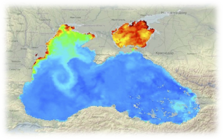
MODIS Terra Sea Surface Temperature (SST)
Products are based on 8 day composite level 3 products available from NASA's Ocean Color Data Distribution Center, covering the time span 2000-2012. The spatial resolution is 4km. The dataset represents the temperature of the water near the surface, expressed as Celsius degrees. The acquisition for this particular parameter is conducted during night-time in the 4 micron band. In the near future, the acquisitions made in the 11 micron band will be also added (for this part of the electromagnetic spectrum, the measurements are made both day and night).Data coming from the other MODIS satellite - Aqua, will be also processed and made available through ESPOSS..
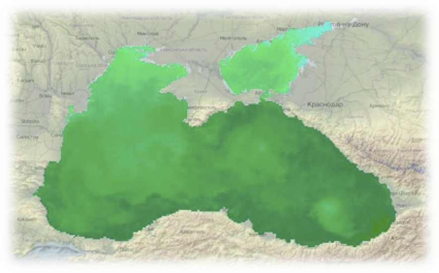
MODIS Chlorophyll (CHL) concentration
Data is based on 8 day composite level 3 products available from NASA's Ocean Color Data Distribution Center for the time period 2000-2012. The spatial resolution is 4km. The chlorophyll values are expressed as mg/m3. Chlorophyll concentration is an important parameter, that is a measure of the abundance of algae (phytoplankton) which represents the main food source for other marine species. Currently, only Terra derived chlorophyll concentrations are available, but Aqua products will also be added..
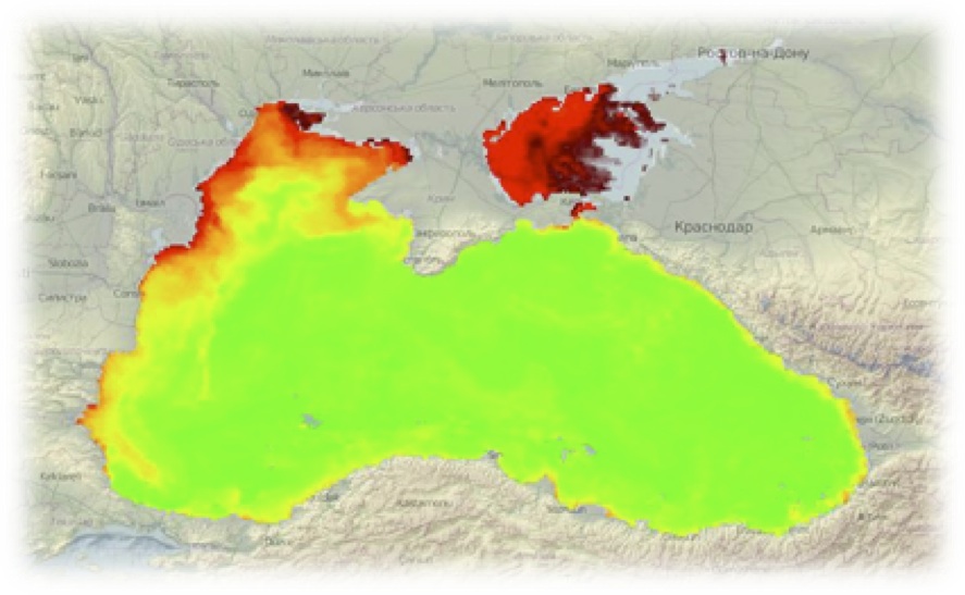
MODIS K490 is the diffuse attenuation coefficient at 490 nm

Which indicates how strongly light intensity at the wavelength of 490 nm is attenuated within the water column. In other words, MODIS K490 is a good indicator of water clarity and turbidity. For example a K490 of 0.1/meter means that light intensity will be reduced one natural log within 10 meters of water, therefore higher K490 value means smaller attenuation depth, and lower clarity of water. The MODIS K490 products are level 3 - 8 day composite, with a spatial resolution of 4km. These products are available for the period of time between 2000 and end of 2012. Currently, only Terra derived chlorophyll concentrations are available, but Aqua products will also be added..
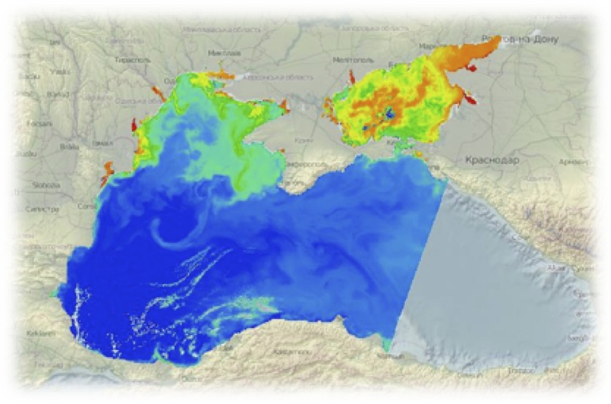
MERIS Chlorophyll
Products are monthly averaged from the data collected by the sensor onboard Envisat platform between 2003 and 2012. The values are expressed as mg/m3. The spatial resolution is 9km. The Level 3 demonstration products have been generated by the G-POD (Grid Processing on Demand) service using MGVIL3 3.2 (JRC), MKL3 3.0 (Acri) and BEAM-L3 3.3 (Brockmann-Consult). Usually, ESA does not deliver level 3 products, but some demonstration products have been produced. .
MERIS Total Suspended Matter (TSM)
products available through ESPOSS are derived from a subset of MERIS Reduced Resolution Geophysical Product delivered by ESA. The time period for which these datasets are available for the moment is between 2000 and 2010, but in the very near future it will be completed with data from 2011-2012. Unlike the other products accessible through ESPOSS, TSM is available on an almost daily basis, but without covering the entire Black Sea area, since it is not a gridded product, but a swath based one. The acquisition spatial resolution is 1.2 km..
News & Announcements
-
2014 Conference on Big Data from Space (BiDS '14)
Posted
-
News: Earth Observation for Ocean-Atmosphere Interactions Science 2014
Posted
-
MyOcean Science Days
Posted
-
World Environment Day - Small Islands and Climate Changes
Posted
-
Black Sea - Kassandra forecast system
Posted
-
ESPOSS New Features
Posted
-
Cooperation with GeoEcoMar
Posted
-
FOSS4G Europe 2014
Posted
-
Earth Observation for Ocean-Atmosphere Interactions Science 2014
Posted
-
Second ESPOSS Workshop
Posted


